Resources: Example Applications
The RAPID facility provides investigators with the equipment, software, and support services needed to collect, process, and analyze perishable data from natural hazard events.
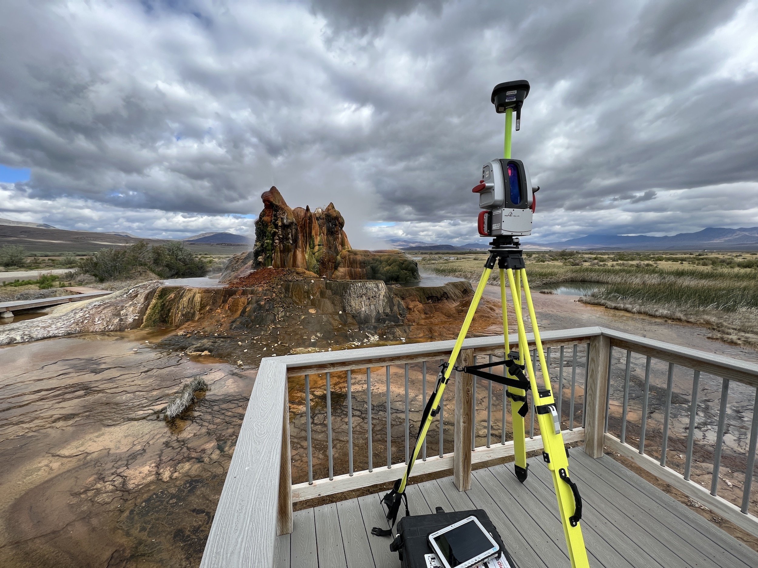
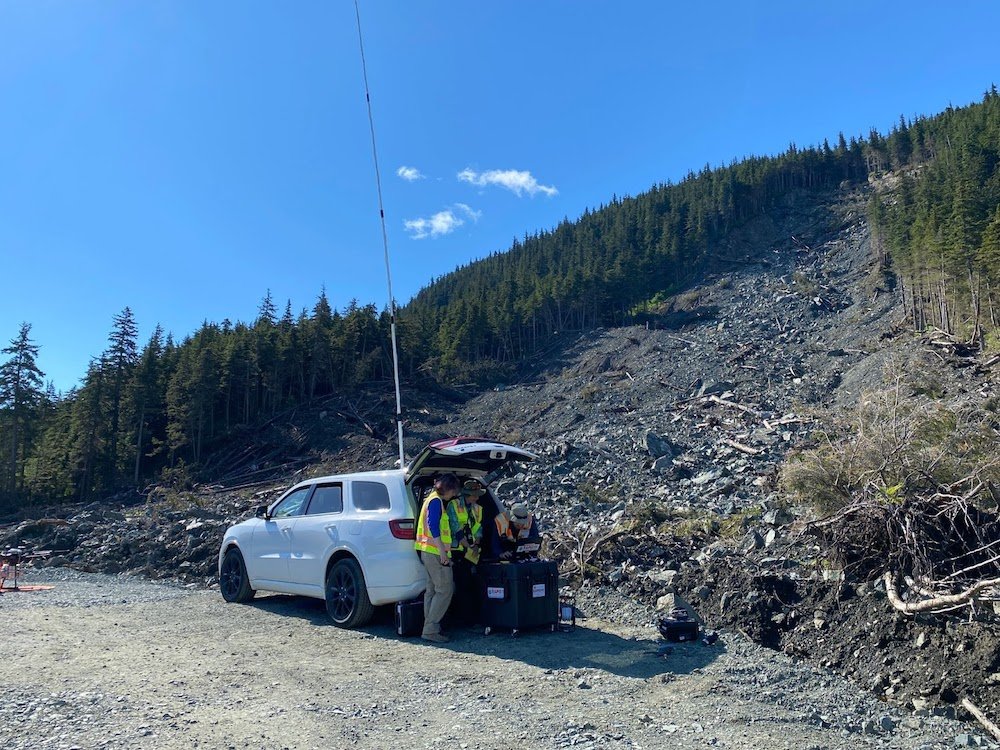
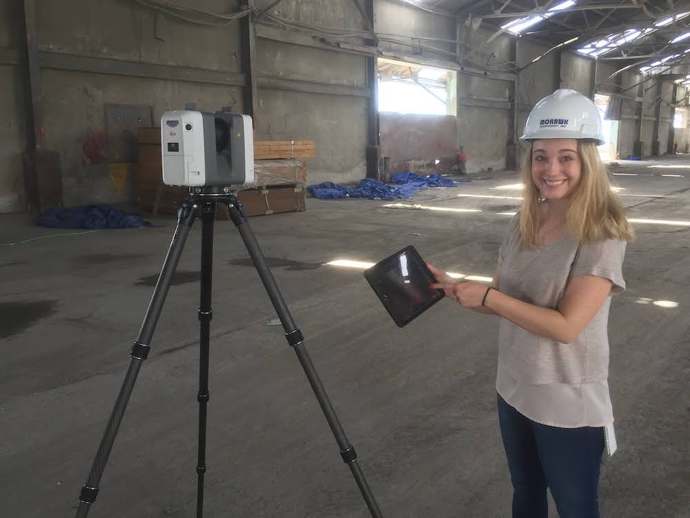
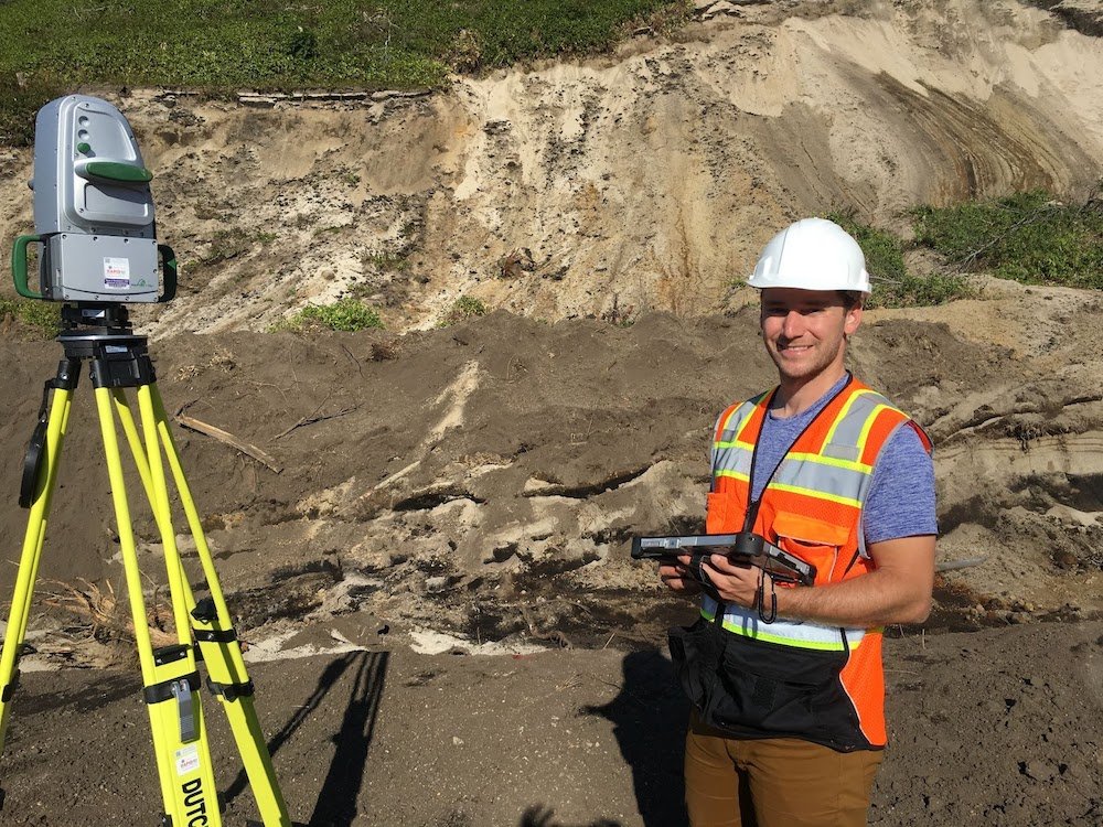
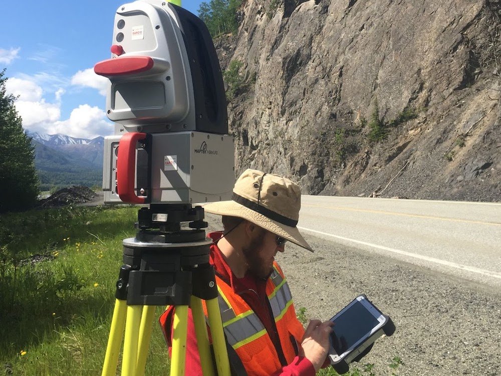
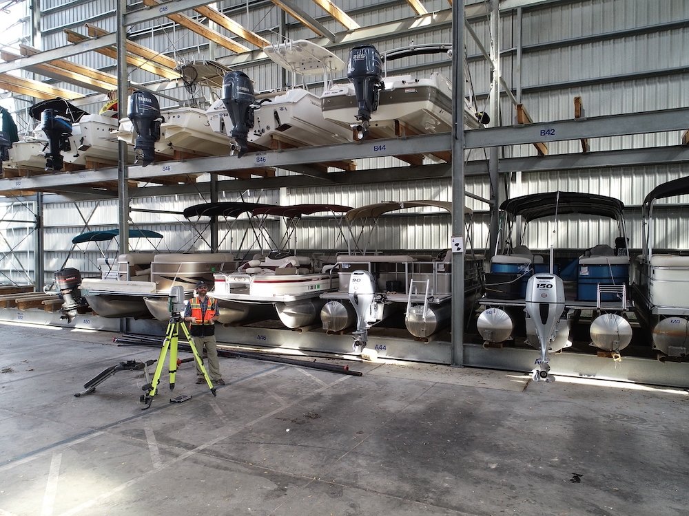
One way that the RAPID achieves this is by providing state-of-the-art data collection equipment, which was selected based on feedback from the natural hazards reconnaissance community, the RAPID External Steering Committee, and the expertise of the RAPID team. Equipment offered by the RAPID includes equipment for multi-hazard broad use (e.g., computing, laser scanning, surveying, unmanned aerial systems, digital imaging, data visualization, and backpacks with natural hazards reconnaissance essentials), site characterization, ground investigation, coastal monitoring and investigation, and social science data collection. The multi-hazard equipment can additionally be used for structural and wind monitoring and damage assessment.
Most of the RAPID equipment is intended for field deployment to regions impacted by natural hazards, or experimental sites used for the study of natural hazards (e.g., for shake table tests). For individuals or groups with training (through our workshops or otherwise), or that prefer to operate on their own, equipment can be directly provided, or equipment can be sent with RAPID staff to assist in field data collection. For either scenario, the RAPID will advise and assist you with use of the RAPID equipment, equipment scheduling protocols, transportation logistics of equipment, and field safety.
The RAPID also provides equipment at the RAPID headquarters for data visualization, data processing and computing. This includes high-powered graphics processing workstations which can be utilized to develop and interrogate models from lidar and structure from motion (SfM) data and analyze data using software associated with RAPID equipment. This also includes a computer automated virtual environment (CAVE) which can be used to further investigate point cloud data (from lidar or SfM) and a 3D printer. The RAPID will assist with limited data processing and archiving data to DesignSafe. For additional data processing needs, inquire with the RAPID.
To facilitate field data collection and data transfer to DesignSafe, the RAPID has also developed a custom mobile application called the RApp, which will continue to have features added. The RApp will be installed on field tablets provided by the RAPID. It will afford users the ability to identify, capture, aggregate, organize, store and manage social science, engineering, and geoscience reconnaissance data, as well as to a lesser extent disseminate, analyze, and visualize that data. It will enable the collection of metadata that will be linked to data collected by RAPID instruments, the collection of social science data through surveys, communication and organization of field team members, geospatial tagging of all collected data, and will assist with troubleshooting equipment in the field by providing equipment manuals and other important features.
Structural Instrumentation
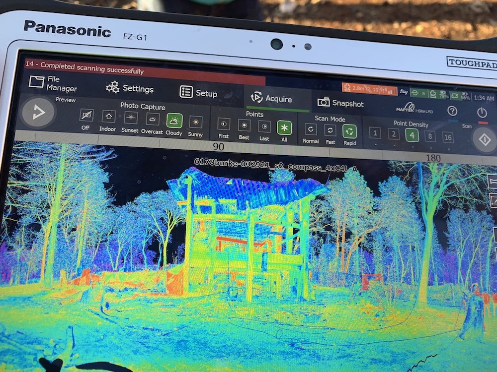
The RAPID equipment portfolio includes a number of instrumentation systems that can be used to document damage sustained by structures as a result of natural hazard and anthropogenic events; commonly used systems include drone-based lidar, drone-based cameras and SfM software, terrestrial lidar, Applied Streetview, GigaPan Epic Pro V and Cannon 7D Mark II.
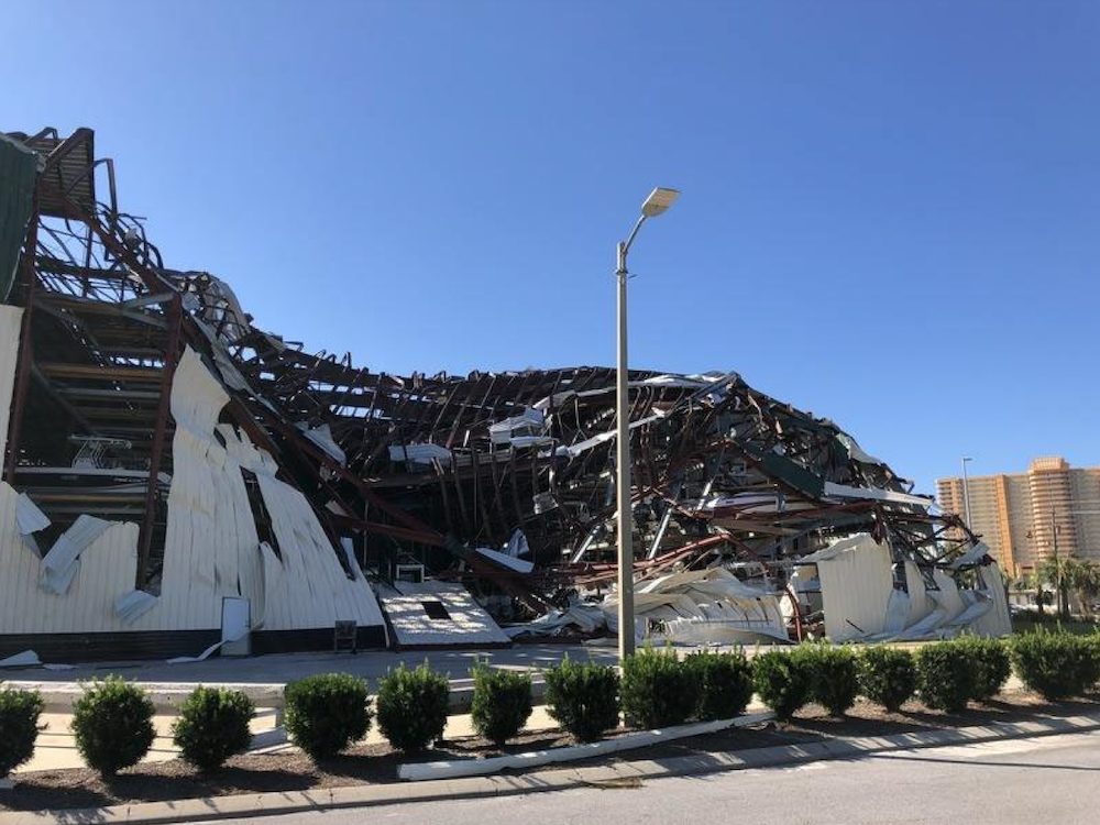
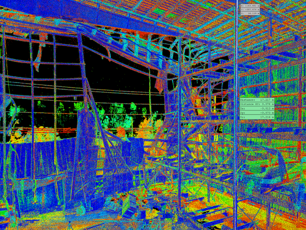
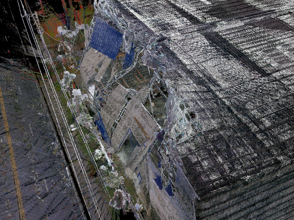
With NSF RAPID funding Auburn University faculty members Justin Marshall and David Roueche and UW faculty member Jeff Berman partnered with RAPID staff to collect data characterizing damage sustained by low-rise, large volume metal structures as a result of Hurricane Michael, which made landfall south of Panama City, Florida on October 10, 2014. In comparison with other types of structures, these buildings exhibited disproportionately high rates of severe damage and collapse and wind demand levels that were judged to be below design level. To collect their data, the research team used multiple still cameras (DJI Osmo, Insta360, Canon DSLR and Flir C3 Thermal Camper), a DJI Phantom equipped with a Zenmuse X5S Camera, Matrice 210 drones with X4S cameras, a Leica robotic total station (TS16I) and Maptek XR3 long-range laser (lidar) scanner. Figures show point clouds generated using SfM methods and image data collected using drone-based cameras.
Geotechnical Instrumentation
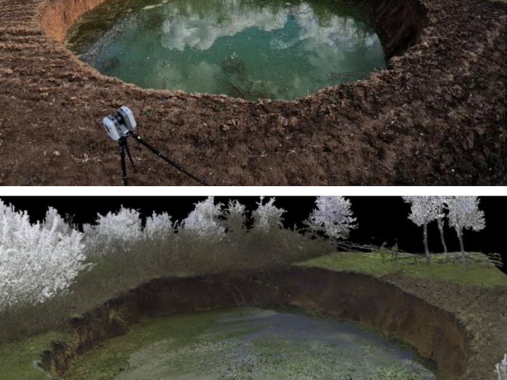

The RAPID Facility has supported field reconnaissance missions investigating the geotechnical aspects of earthquakes, major flood and erosion events, landslides, and other geohazard events. For example, a recent project led by Geological Engineering Professor Margaret M. Darrow of the University of Alaska Fairbanks used the facility’s UAV-based aerial and terrestrial lidar systems to map the 2020 Haines, Alaska, landslide. In 2022, Professor Darrow and her students redeployed with RAPID Facility staff to acquire a second set of UAV-based lidar data to measure subsequent changes to the landslide and better understand the recovery of the landscape. A key benefit of the facility’s lidar systems is that they can penetrate vegetation on and near the landslide, allowing a “bare-earth” digital elevation model (DEM) of the area to be developed. Professor Darrow’s work on the Haines landslide is featured in the journal Landslides.
The RAPID Facility has supported many Geotechnical Extreme Event Reconnaissance (GEER) Association-sponsored missions in the United States and abroad. In 2020, Professor Ingrid Tomac of the University of California San Diego deployed to Croatia with RAPID instrumentation to investigate the geotechnical aspects of the Petrinja Seismic Sequence. Professor Tomac and her research collaborators used terrestrial lidar to quickly map sinkholes that developed during the earthquake. The GEER team also used RAPID seismometers to assess the dynamic site characteristics of the karst terrain that underlies the impacted region.
The RAPID Facility has supported other GEER earthquake investigations, including a field reconnaissance of the 2019 Ridgecrest earthquake sequence in Southern California. This mission, led by Professor Scott Brandenberg of the University of California Los Angeles, focused on mapping, measuring, and recording surface fault rupture across a multiple square kilometer region. To support this research, the RAPID facility deployed pilots with several UAVs to fly and acquire data in the impacted area. The research team later used these UAV data to develop structure from motion photogrammetry-derived, high-resolution digital elevation models of the complex multi-fault system in the region.
Learn more about our geotechnical deployments →
Coastal Instrumentation
The RAPID Facility has deployed a variety of equipment in support of disaster reconnaissance and in support of other engineering and monitoring activities in the coastal zone.
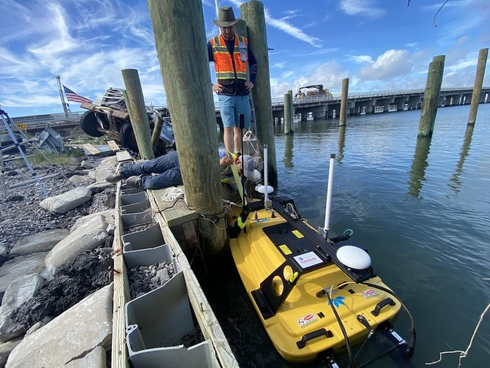
Following Hurricane Ida landfall in Louisiana in 2021, the RAPID Facility supported a joint GEER and NEER deployment to Grand Isle, LA. The hurricane caused significant damage to the built and natural environment due to the combined impacts of storm surge, strong winds, and heavy rainfall. The storm claimed 87 lives and resulted in $75 billion in direct economic damage. The joint NEER/GEER team was led by Associate Professor Navid Jafari of Louisiana State University and Associate Professor Adda Athanasopoulos-Zekkos of University of California, Berkeley. The team measured nearshore bathymetric changes, damage to the coastal levee and post-hurricane waste management. The RAPID Facility deployed a suite of equipment, including multiple drones, the Leica RTC360 scanner and the Z-boat.
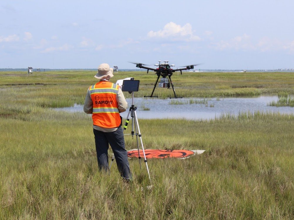
The U.S. Army Corps of engineers piloted the cost-savings application of drone-based lidar to monitor elevation change following dredging activities to maintain navigable waterways and restore natural habitats—a billion dollar a year endeavor. In 2021, the RAPID Facility deployed its DJI Mavic Pro drone and the miniRanger UAS LIDAR system to map elevation changes in a restored marsh in Gull Island, NJ.
Learn more about our coastal deployments →
Social Science Instrumentation
Streetview
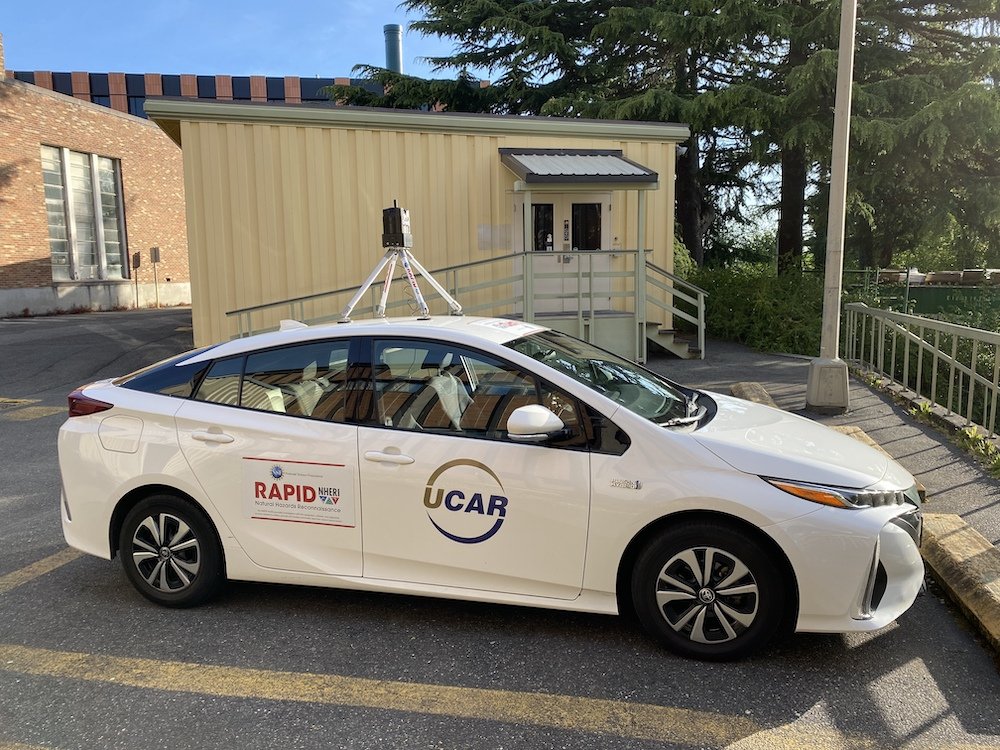
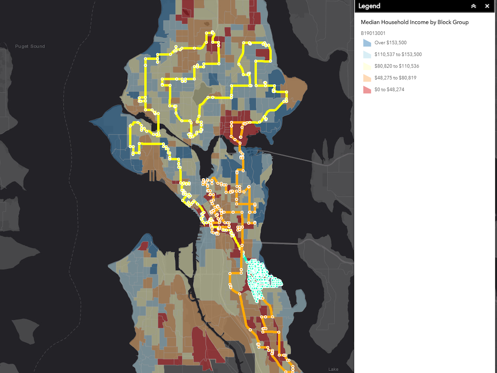
In their study titled, “Using Streetview to Assess Community-Level Impacts and Recovery from a Global Public Health Emergency,” researchers based out of the University of Washington, including Drs. Nicole Errett, Youngjun Choe, Joseph Wartman, and Scott Miles, wanted to explore the impacts of public health risk mitigation measures implemented during the COVID-19 pandemic on community, economic, public health, social, cultural, and built capital. Since May 2020, they have used the Streetview car mount camera system to systematically capture 360 imagery data along a predetermined route within Seattle to “map” Seattle’s recovery throughout the pandemic.
RApp
The December 10-11, 2021, tornado outbreak was the deadliest December tornado event on record, with 74 reported fatalities in western Kentucky alone. This prompted critical questions about how people in the affected regions received risk information about and protected themselves from the threat of severe weather. A social science research team led by Florida State University Assistant Professor John Mathias aimed to understand household sheltering behavior and shelter access in western Kentucky following the December 10-11, 2021 tornado outbreak. In March 2022, they administered a questionnaire adapted from a NOAA tornado post-event survey using the RApp application, ultimately gathering 134 household surveys that they then used to identify participants for follow-up focus group interviews.
Learn more about our social science deployments →
Experimental Instrumentation
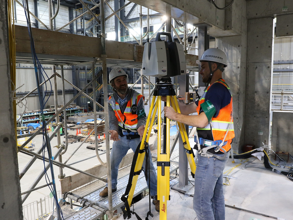
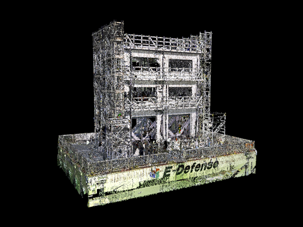
UW Associate Professor Paolo Calvi and graduate student Tatsu Sweet partnered with RAPID faculty and staff to collect data characterizing damage sustained by a full-scale three-story reinforced concrete building subjected to simulated earthquake shaking on the shake table at the E-Defense facility in Miki City, Japan, in December 2019. RAPID equipment used in the study included the Leica BLK360 and Leica ScanStation P50 terrestrial lidar in combination with Leica surveying equipment and Canon cameras. The test program consisted of subjecting the structure to a series of earthquake ground motions with increasing amplitude; RAPID instrumentation was used to collect data prior to testing and after each ground motion. To collect dense point cloud datasets, characterizing both global deformation of the structure as well as local damage (e.g., concrete cracking and spalling), surveying equipment was used to establish the location of a series of high-resolution targets placed on the shake table facility (stationary), the shake table, and the building. The Leica BLK360 system was used at maximum resolution (3 mm at 10 m accuracy) requiring approximately 5 minutes to collect a full 3D point cloud with photographic image overlay; these data were supplemented with point cloud data collected using Leica P50 scans at maximum resolution (0.8 mm at 10 m), which required ~60 minutes to complete a full 360 scan.
Earthquake Instrumentation
The RAPID Facility has deployed a variety of instrumentation to support researchers studying earthquakes and cascading hazards such as landslides, rockfalls, liquefaction, and tsunamis. As an example, Alex Grant of the U.S. Geological Survey and other members of a GEER team deployed to Tomakomai, Hokkaido, Japan following a major earthquake to compile an inventory of landslides and lateral spreads using the RAPID Facility’s Leica BLK360 and Maptek XR3 laser scanners.
Researchers Lucas Hogan and Max Stephens at the University of Auckland, New Zealand documented the structural damage sustained in a building following the 2016 Kaikoura Earthquake. The team collected over 800 scans to thoroughly document the building using the BLK360 laser scanner and later the RTC360 laser scanner. This work was completed through an international collaboration between the RAPID Facility and QuakeCoRE.
RAPID staff went to Ponce, Puerto Rico, in support of a project to determine if the impacts of Hurricane Maria resulted in an increased level of damage — or caused unexpected modes of failure — during the 2020 earthquake series. The team — led by Associate Professor Arash Zaghi and Assistant Research Professor Alexandra Hain, both at the University of Connecticut, and Professor Jamie Padgett at Rice University — collected a comprehensive dataset using standard and 360-degree geotagged photography, aerial images from a drone, and structural scans of damaged buildings from the Leica RTC360 scanner.
After the 6.4-magnitude earthquake in Petrinja, Croatia, on Dec. 29, 2020, nanometrics triaxial seismometers and Ingrid Tomac, Assistant Professor at the University of California, San Diego, deployed with a Leica RTC360 laser scanner to study the numerous sinkholes that formed.
In response to the Fagradaldsfjall earthquake swarm (a series of small earthquakes) and a volcanic eruption in Iceland, Associate Professor Christopher Hamilton of the University of Arizona used RAPID instrumentation to collect high resolution (centimeter-scale) preliminary digital elevation models of potential eruption sites. Maps are also being constructed to determine links between surface fracture patterns and earthquake source mechanisms. Instrumentation included a drone and aerial cameras.
Lastly, several deployments utilized the RAPID equipment following the Palu Indonesia Earthquake and Tsunami. RAPID director Joe Wartman deployed to support the GEER reconnaissance mission to map and characterize massive ground failures (e.g., flowslides) using RAPID instrumentation such as UAVs and a Leica GNSS. A team from USC deployed using the Leica BLK360 scanner to capture tsunami impacts in Palu Bay.
These are but a few highlights of the many earthquake focused deployments the RAPID has assisted with since launching operations.
Hurricane Instrumentation
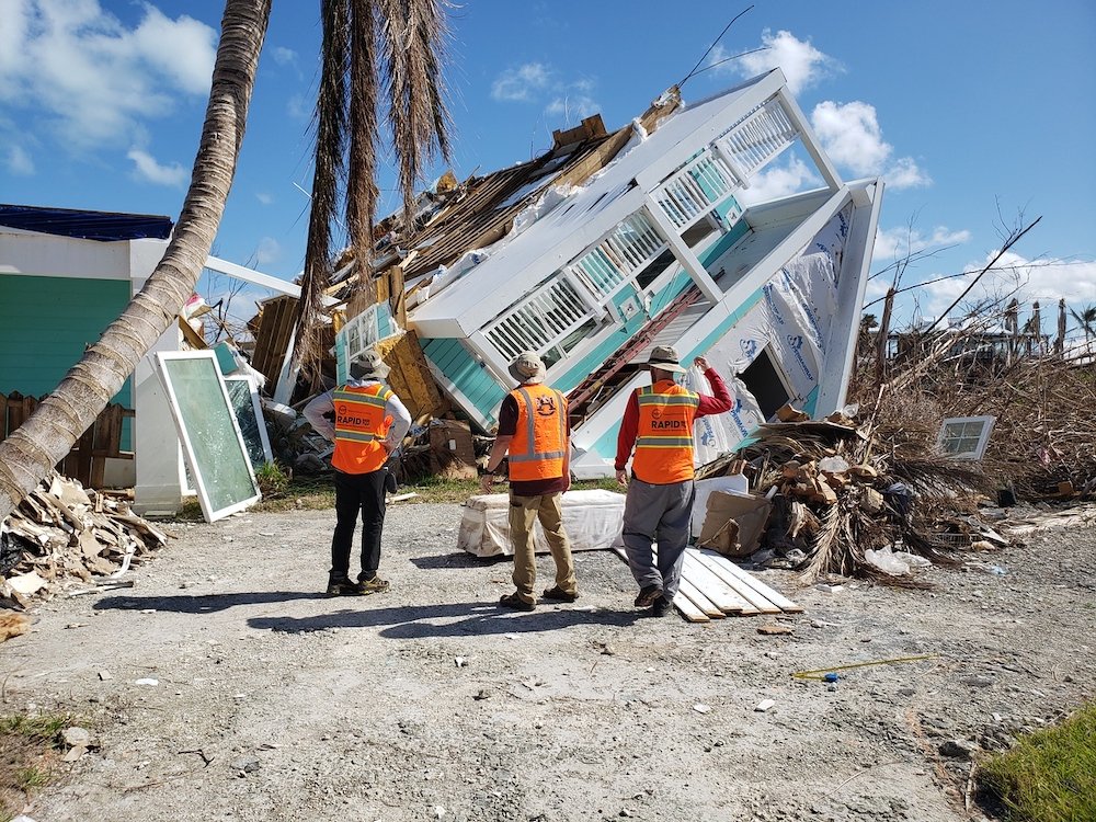
RAPID Facility instrumentation has been deployed to document damage from over a dozen extreme wind events including wind storms in Washington State, hurricanes throughout the southeast, tornadoes across the south and midwest, and the Iowa Derecho. A common component in virtually all of these investigations includes the deployment of Streetview to capture the as-damaged state of the natural and built environment. Partnering reconnaissance groups such as StERR and GEER have assembled large teams of field experts and enhanced their data collection via RAPID drones, Lidar scanners and Streetview. Follow-up detailed studies from individual investigators focus on a specific building type (e.g. large volume buildings), lifelines (e.g. water towers), and comparative structural performance (e.g. pre- and post- Florida Building Code residential structures).
Wind events are often multi-hazard by nature. Some deployments also used RAPID instruments to document hydrodynamic coastal processes and associated geological failures such as landslides and coastal erosion from Hurricane Florence, and the characterization of design-level surge and resultant damage from Hurricane Michael.
Wildfire Instrumentation
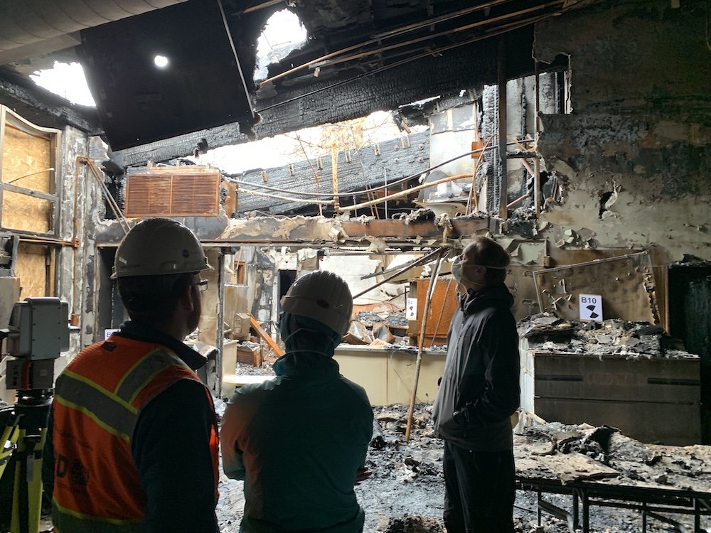
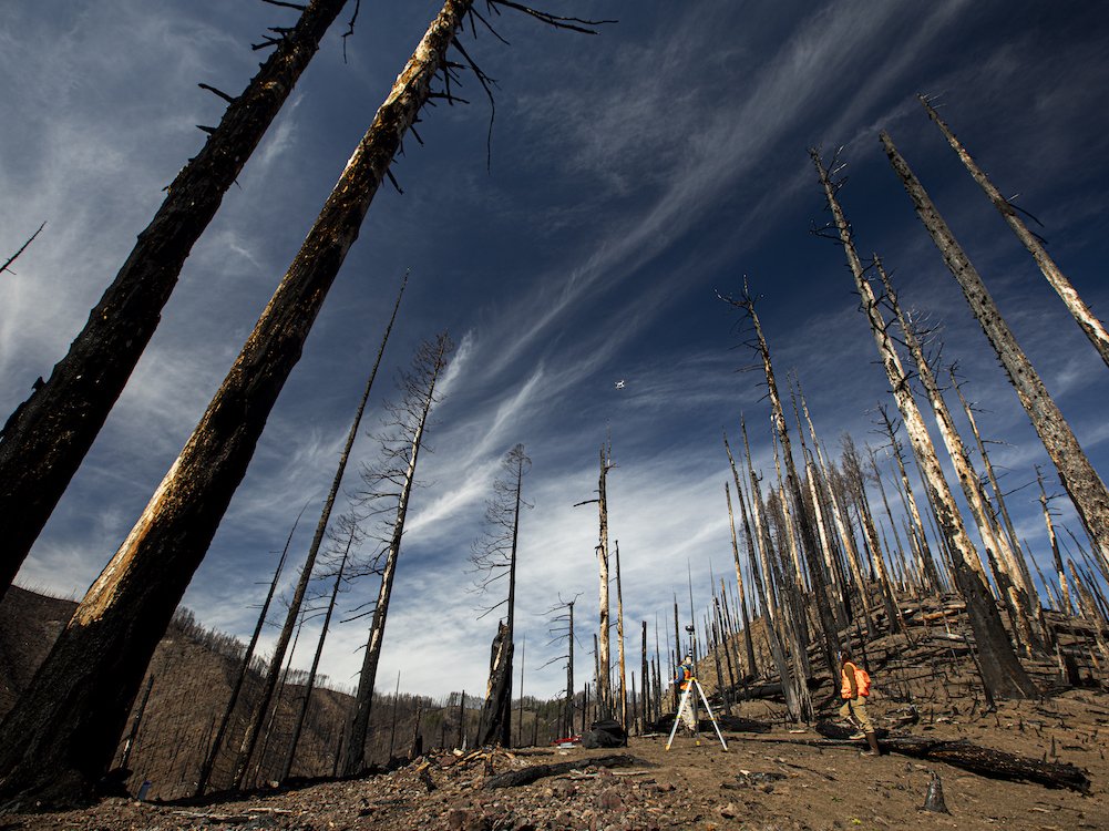
The RAPID Facility has deployed instrumentation and staff to wildfires across the United States. For example, the RAPID collaborated with Oregon State University Assistant Professor Erica Fischer’s research team to assess the post-fire performance of engineered buildings and investigate the performance of pre-fire mitigation for the 2018 Camp Wildfire in Paradise, CA. The team used terrestrial laser scanners to capture structural elements and burn characteristics for finite element modeling, collected 360° streetview data for debris disposal and recovery monitoring, and flew UAS to capture orthomosaics of wildfire mitigation efforts.
RAPID deployed with University of Oregon Professor Josh Roering’s GEER team to the Holiday Farm, Archie Creek, and Eagle Creek fires in Central Oregon. The team used the Maptek XR3 long-range terrestrial laser scanner to capture digital terrain of landslide risk hillslopes and RTK-enabled UAS to generate 3D models and orthomosaics to characterize and quantify post-fire debris flow potential in catchments.
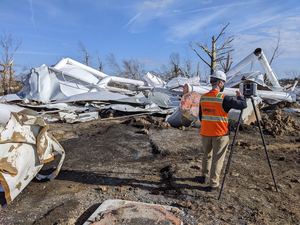
The Marshall Fire in Superior, Colorado, destroyed over 20,000 homes and raised questions about structural burn severity in the wildland urban interface. A reconnaissance team led by Erica Fischer (OSU), Brad Wham and Shideh Dashti (UCBoulder) collaborated with the RAPID to collect approximately 6 sq miles (3780 acres) of high-resolution imagery with RAPID’s fixed-wing UAS and ultra-high precision terrestrial lidar scans of burned structures to measure structural components where site access was not possible.